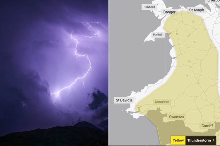
A yellow warning for thunderstorms, heavy rain and hail has been issued for Tuesday afternoon by the Met Office.
The warning covers much of Wales, but excludes coastal areas in the west.
The Met Office says: "Heavy showers and thunderstorms are expected to develop during the afternoon across parts of southwest England, Wales and the West Midlands before slowly dying out during the evening.
"Many places will miss the worst, but where they do develop, some slow-moving and intense downpours are possible, giving accumulations of 20-30 mm in around 1 hour, and a lower likelihood of 40-50 mm in 2-3 hours in a few locations.


"Frequent lightning strikes and hail are also possible."
The warning is in place from midday Tuesday until 9pm.
The storms could cause some travel disruption, flooding and there is a slight chance of power cuts.
The warning area covers much of Wales but remains mainly inland, with coastal regions not covered in the warning area.
More wet weather
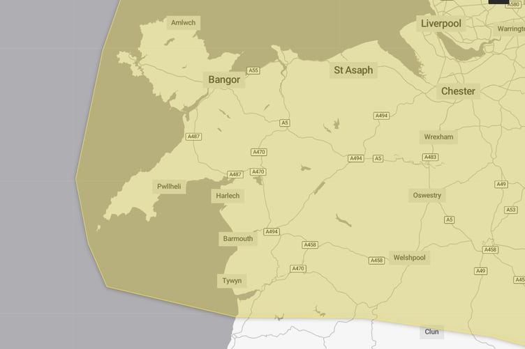
A second weather warning has also been issued for Wednesday and Thursday.
The warning area, which covers north Wales, just north of Aberystwyth, runs from 12.15am on Wednesday until 6am on Thursday.
The Met Office says: “An area of rain is expected to develop across eastern and central England and then move northwestwards to affect northern England and north Wales during Wednesday afternoon.
“The area of rain could then become slow moving, heavy and persistent, especially over north facing hills, before clearing during Thursday morning.
“There is a lot of uncertainty over exactly where the heaviest rain will occur and this warning is likely to be updated.
“Many places will see 30-40 mm of rain, while a few areas may receive 60-80 mm. There is also a small chance that a few upland areas could see much higher totals, in the order of 100-150 mm.”
Comments
This article has no comments yet. Be the first to leave a comment.